East Merkland, Strathaven, Lanarkshire
Installation type: Wind Farm
Installation size: 13.5 MW
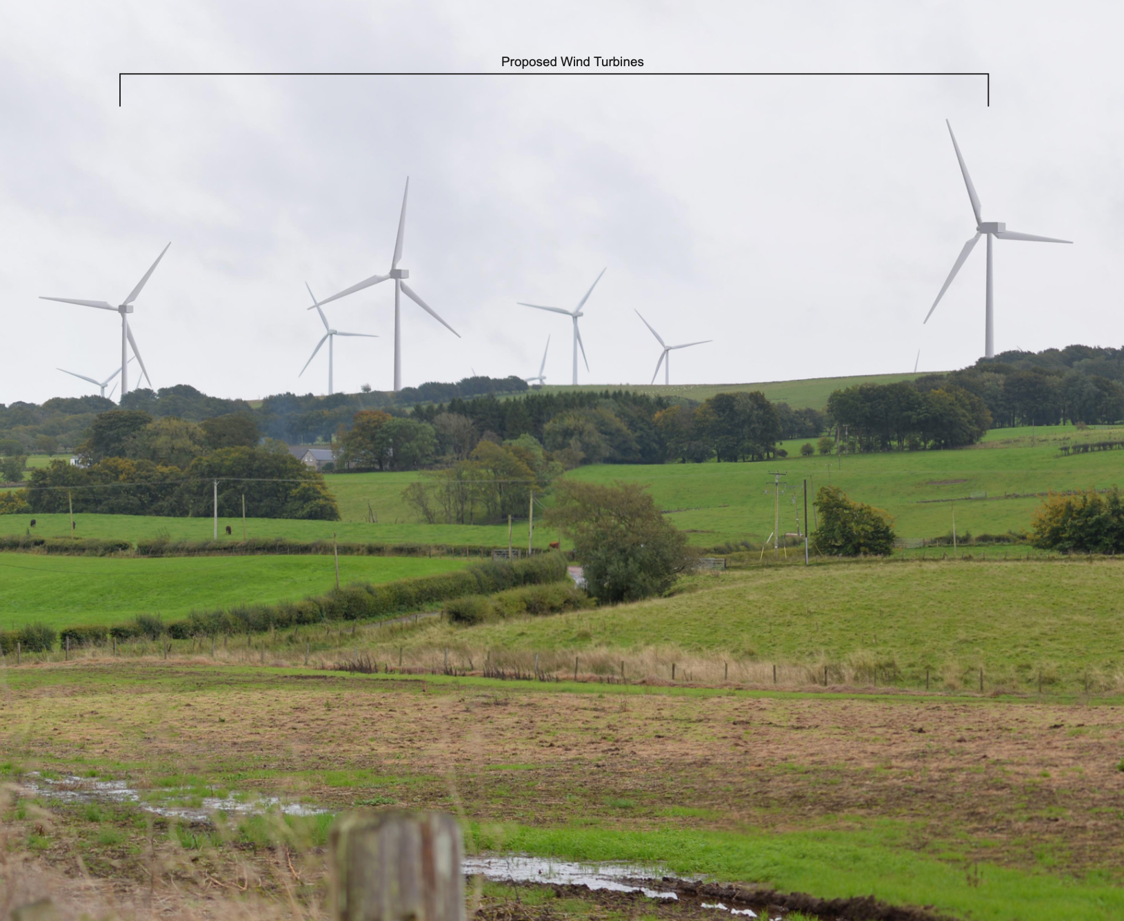
CleanEarth are proposing three wind turbines on Land at East Merkland, Strathaven, Lanarkshire, ML10 6RP.
The proposal has an estimated annual energy yield of approximately 44 GWh, the equivalent of powering over 12,000 South Lanarkshire homes. The project will save more than 9,400 metric tonnes of carbon annually, with a predicted lifetime saving of over 330,000 metric tonnes – making a significant contribution to Scotland’s carbon reduction targets to reach net-zero carbon emissions by 2045, and the UK’s target to achieve this by 2050.
A public consultation will be held on Wednesday 22 November 2023 from 3pm to 7pm at Strathaven Hotel, Hamilton Rd, Strathaven, ML10 6SZ. Please note this is an open event with no appointment required. However registering your interest prior to the event is encouraged, via phone on 01208 895576 (ext 308) or by email.
The planning statement and supporting information will be published below. Comments can be submitted through an online questionnaire that will be available during the event and for 28 days afterwards.
Any further enquiries can be sent to eastmerkland@cleanearthenergy.com or by using the form below.
Appendix B – Site Plans:
Block Plans
Entrance Plans
Location Plans
Appendix C – Turbine Specification:
Turbine Spec
Appendix D – Landscape & Visual Impact Assessment:
LVIA Report
Fig 1 – Location Plan
Fig 2 – Site Analysis
Fig 3 – Cumulative Wind Energy Schemes
Fig 4 – Landscape Relevant Designations
Fig 5 – National and Regional Landscape Character
Fig 6 – Local Landscape Character
Fig 7 – Principal Visual Amenity Receptors
Fig 8A – ZTV to Hub (45km)
Fig 8B – ZTV to Blade Tip (45km)
Fig 9A – ZTV to Hub (15km)
Fig 9B – ZTV to Blade Tip (15km)
Fig 10A-C – Viewpoint 1
Fig 11A-C – Viewpoint 2
Fig 12A-C – Viewpoint 3
Fig 13A-C – Viewpoint 4
Fig 14A-C – Viewpoint 5
Fig 15A-C – Viewpoint 6
Fig 16A-C – Viewpoint 7
Fig 17A-C – Viewpoint 8
Fig 18A-C – Viewpoint 9
Fig 19A-C – Viewpoint 10
Fig 20A-C – Viewpoint 11
Fig 21A-C – Viewpoint 12
Appendix E – Ecology:
Ecological Impact Assessment
Habitat Management Plan
Habitat Survey
OCEMP
Ornithological Survey
Protected Species Survey
Appendix F – Heritage:
Heritage Impact Assessment
Appendix G – Noise:
Noise Impact Assessment
Appendix H – Hydrology & Geology:
Peat and Hydrology Assessment
Peat Survey Report
Watercourse Crossing Inventory
Fig 1 – Hydrological Setting
Fig 2 – National Soil Map
Fig 3 – SNH Carbon and Peatland Map 2016
Fig 4 – Superficial Geology
Fig 5 – Bedrock Geology
Fig 6 – Water Features
Fig 7 – Potential GWDTE
Fig 8 – Peat Depth of Penetration
Fig 9 – Estimated Peat Depth
Appendix J – Shadow Flicker:
Shadow Flicker Assessment
Appendix K – Construction Transport Management Plan:
Appendix M – EMI & Aviation:
Aviation Statement